Jacques Le Moyne de Morgues “Brevis narratio eorum quae in Florida Americae provincia Gallis acciderunt”

Jacques Le Moyne de Morgues “Brevis narratio eorum quae in Florida Americae provincia Gallis acciderunt”

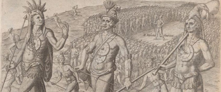
De Morgues’ book gives a detailed account of the tragic fate of the French colony in Florida who were killed by the Spanish in the 16th century. Jacques le Moyne de Morgues was a French artist and member of Jean Ribault’s expedition to the New World. His depictions of Native American life and culture, colonial life, and plants are of extraordinary historical importance.

Lemoyne de Morgues, Jacques. Brevis narratio eorum quae in Florida Americae provincia Gallis acciderunt (Brief Narration of Those Things Which Befell the French in the Province of Florida in America.) Published by Theodor de Bry, 1519.

Read a selected transcript with color images from the National Humanities Center. 

View the book on the Internet Archive.

De Orbe Novo: The Eight Decades of Peter Martyr D’ Anghera

De Orbe Novo: The Eight Decades of Peter Martyr D’ Anghera

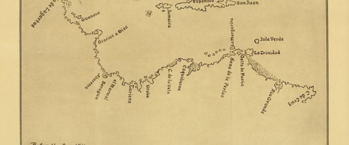
Peter Martyr D’Anghera was a priest in the Roman Catholic Church and chronicler for Spain. As a chronicler, Peter Martyr was tasked with recording Spain’s endeavors in the New World. In the “Seventh Decade” of his De Orbe Novo, Peter Martyr D’Anghera recounts the experience of Francisco of Chicorana, a Native American captured by Lucas Vasquez De Ayllon and brought to Santo Domingo where he met Peter Martyr. Archeologist David G. Anderson argues the account offers “considerable value, as it presents the first detailed description of Southeastern chiefdom societies…”

De Orbe Novo: The Eight Decades of Peter Martyr D’Anghera. Translated from Latin with Notes and Information by Francis Augustus MacNutt. Volume Two. New York and London: G.P. Putnam’s Sons, 1912.

View the full book on the Internet Archive.

Diego Ribero 1529 World Map of Spanish Global Conquests

Diego Ribero 1529 World Map of Spanish Global Conquests

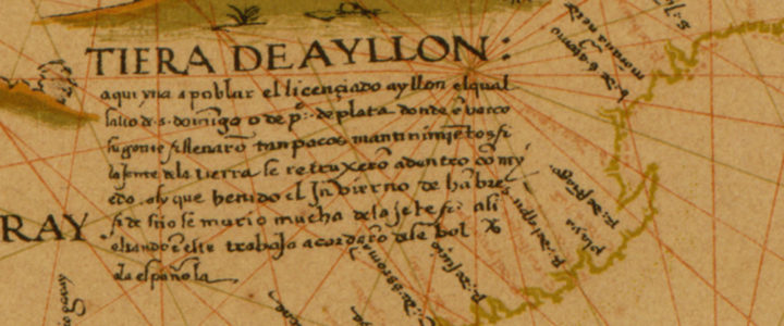
Diego Ribero created his world map in 1529 to celebrate Spanish global conquests. Ribero was a Portuguese artist who created this map to prove that the Moluccas islands in the Indonesian archipelago belonged to the Spanish in accordance with the 1494 Treaty of Tordesillas. The De Orbe Novo map used art and geography to give the Spanish an edge in the spice trade.  It took hundreds of years to disprove Ribero’s work.

Ribero, Diego. 1529 World Map also called the Propaganda Map. London : W. Griggs,[1887?]. from the Library of Congress, Geography and Map Division.
View the map from the Library of Congress.


Spanish Missions of Georgia Map

Spanish Missions of Georgia Map

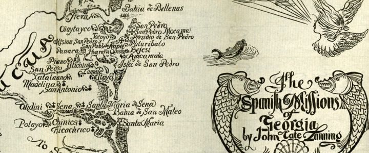
The map of Spanish missions in Georgia was created in 1935 to show the locations of Georgia’s Spanish missions during the Spanish colonial period. Current research on the locations of Spanish missions may refute some of the work done by historian John Tate in developing this map.

Map of Spanish Missions in Georgia illustrated by Willis Physioc (1935) in Landing, John Tate, The Spanish missions of Georgia. Georgia Historical Society Rare Book Collection.

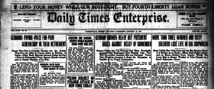
Daily Times Enterprise Newspaper, October 12, 1918

Daily Times Enterprise Newspaper, October 12, 1918

On September 25th, 1918, an estimated 130 men from Georgia lost their lives in a tragic accident as a violent wave caused a crash between the Otranto and Kashmir, two ships carrying troops to England. The crash caused the Otranto to veer off course and sink. The small town of Nashville, Georgia lost 20 citizens in the accident. Residents of Nashville erected a monument to the victims of the disaster after the war. The front page of the Daily Times Enterprise on October 12, 1918, covers more WWI topics than the Otranto sinking. The front page offers general war news and, in the left corner, an ad for war bonds and stamps.

Etowah Papers

Etowah Papers

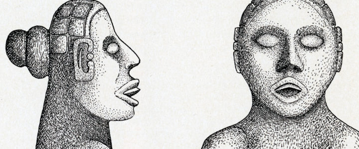
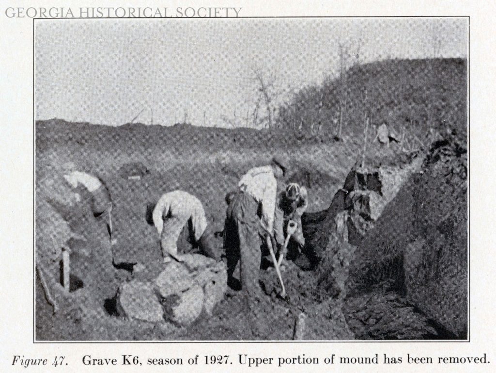
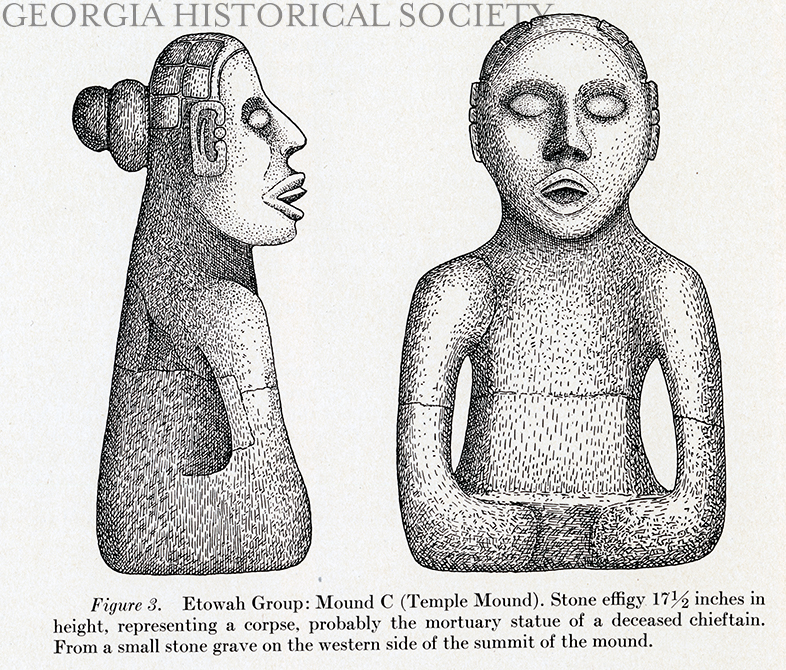
Published in 1932, The Etowah Papers is a collection of articles edited by famous archaeologist Warren King Moorehead. This primary source set provides access to the figures in the first article of the book written by Moorehead. The figures provide visual representations of the excavation site, mounds, artifacts discovered, and the process of excavation. The artifacts reveal the complex nature of the Mississippian culture and give some insight into what the mounds were used for.

Moorehead, Warren King. “Exploration of the Etowah site in Georgia.” In Etowah Papers: Exploration of the Etowah site in Georgia. New Haven: Published for Phillips Academy by the Yale University Press, 1932.

Learn more about the Etowah Mounds from Georgia State Parks.

Letters between FDR and America’s German Ambassador William Dodd

Letters between FDR and America’s German Ambassador William Dodd

Franklin D. Roosevelt has a special connection to Georgia. The home he built in Warm Springs is known as “the little white house.” Roosevelt relished his time in Warm Springs, and it became a refuge from the rigors of the presidency. The letters included in this primary source set are written by FDR while at Warm Springs. The letters chronical the correspondence between President Roosevelt and Ambassador William Dodd. The first letter is a response to the Ambassador to Germany William Dodd’s letter describing the political situation in Germany in 1935. Both letters are available through the FDR Presidential Library and Museum.


Letter from President Franklin D. Roosevelt to William Dodd, Ambassador to Germany.December 2, 1935. Folder: Germany: William E. Dodd: 1933-35. Franklin D. Roosevelt Library, Hyde Park, New York.

Access the letter from the FDR Library.


October 30, 1935 letter from William Dodd to FDR. Folder: Germany: William E. Dodd: 1933-1935. Franklin D. Roosevelt Library, Hyde Park, New York.

Access the letter from the FDR Library.

WPA District 8 Scrapbook, 1940-1941

President Franklin D. Roosevelt created the Works Progress Administration (WPA) by executive order in 1935 as a part of his New Deal. The WPA acted as a work-relief program hiring unemployed citizens to build roads, bridges, airports, public parks, and other public facilities. WPA programs also included the federal art, music, theater, and writer’s projects. People were also employed for other tasks, including sewing, bookbinding and working in schools.

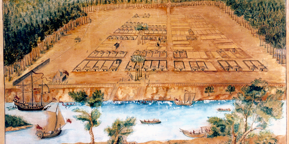
View of Savannah in 1734

View of Savannah in 1734

Peter Gordon’s 1734 “View of Savannah” provides a visual representation of the early settlement on the banks of the Savannah River. Peter Gordon, one of the colonies original settlers presented it to the Trustees in London as a descriptive map. This image is a watercolor on paper of the original Peter Gordon sketch. The map shows Oglethorpe’s unique design for the city. The plan was based on a system of town wards, each containing building lots, trust lots, and a central square.

View of Savannah as it stood on 29th of March 1734. From the Georgia Historical Society Map Collection, 1361MP-001.

View a description of the item in the GHS Image Catalog.

Letters of Gov. James Wright, 1774-1789

Letters of Gov. James Wright, 1774-1789

The letters between Governor Wright and the Secretaries of State for America between 1774 and February 1789 detail the goings on of the Georgia colony from the perspective of its Royal Governor. The letters written leading up to and during the American Revolution are particularly interesting for understanding the tensions between the British government and revolutionaries.

View a description of the James Wright Papers, MS 0844 where the letters come from on the GHS Archival Collections Finding Aids Database.

View the item on the Internet Archive.